River Access Maps
$15.00 – $16.00
iver Rat Maps are extremely detailed and are by far the best maps we have found for rivers in our area.
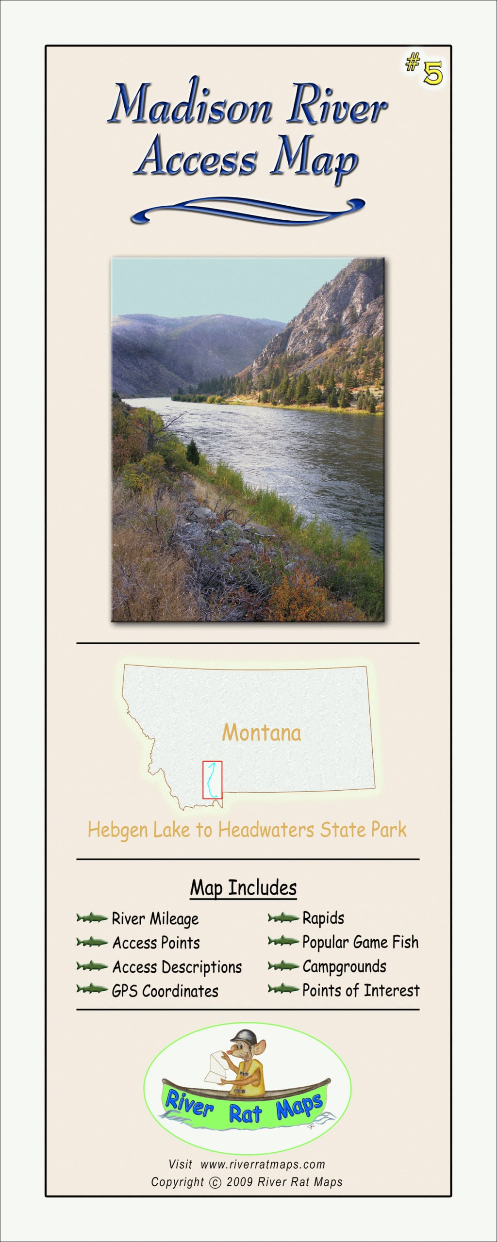
- Madison River: Hebgen Lake to Headwaters State Park
- Gallatin River: Yellowstone Park To Headwaters State Park
- Big Hole River: Wisdom to Twin Bridges
- Beaverhead River: Clark Canyon Reservoir to Twin Bridges
- Jefferson River- Twin Bridges to Headwaters State Park
- Yellowstone River #1: Gardiner to Livingston
- Yellowstone River #2: Livingston to Columbus
- Upper Missouri River #1 Chain of Lakes Complex: Three Forks to Wolf Creek
- Upper Missouri River #2: Holter Dam to Fort Benton
Map Features:
- River Mileage
- Access Points
- Access Descriptions
- Diversion Dams
- GPS Coordinates
- Rapids
- Popular Game Fish
- Campgrounds
- Points of Interest
- Maps are in color; 4×10 folded, opens to 24×10 inches.
Description
River Rat Maps are extremely detailed and are the best maps we have found for rivers in our area.
- Madison River: Hebgen Lake to Headwaters State Park
- Gallatin River: Yellowstone Park To Headwaters State Park
- Big Hole River: Wisdom to Twin Bridges
- Beaverhead River: Clark Canyon Reservoir to Twin Bridges
- Jefferson River- Twin Bridges to Headwaters State Park
- Yellowstone River #1: Gardiner to Livingston
- Yellowstone River #2: Livingston to Columbus
- Upper Missouri River #1 Chain of Lakes Complex: Three Forks to Wolf Creek
- Upper Missouri River #2: Holter Dam to Fort Benton
Map Features:
- River Mileage
- Access Points
- Access Descriptions
- Diversion Dams
- GPS Coordinates
- Rapids
- Popular Game Fish
- Campgrounds
- Points of Interest
- Maps are in color; 4×10 folded, opens to 24×10 inches.
You must be logged in to post a review.


Reviews
There are no reviews yet.